Routes
Routes worth the drive
Known riding routes mapped stop by stop, plus routes shared by Equestrian Hubs members. Open any of them in the free planner and make it your own.
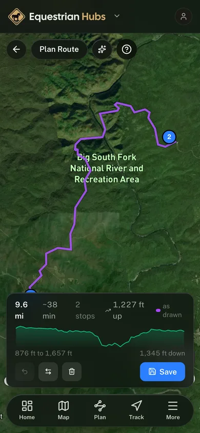
Big South Fork Ride
Premier backcountry horse country, Bandy Creek out to the Station Camp river bottoms.
Custer State Park Ride
Black Hills granite and ponderosa pine from Sylvan Lake down toward the park core.
Shore-to-Shore Trail
The Michigan classic, Lake Michigan at Empire across the state to Lake Huron at Oscoda.
River to River Trail
The Shawnee National Forest crossing, Camp Cadiz west past Garden of the Gods to One Horse Gap.
Centennial Trail, Black Hills
The middle of South Dakota’s 111 mile Centennial Trail, Dalton Lake past Pactola to Sheridan Lake.
Cross Florida Greenway Ride
The Marjorie Harris Carr Greenway from Ross Prairie east through Santos to the Baseline trailhead.
Land Between the Lakes Ride
Out of Wranglers Campground into the LBL trail system, toward the Golden Pond center.
Hill Country State Natural Area
Texas hill country riding out of Bandera, across West Verde Creek and up into the ridges.
East Camino Road
A difficult riding route at Los Padres Outfitters — 13.1 miles, mapped from OpenStreetMap.
South Fork Payette River Trail
A moderate riding route at Sawtooth Wilderness Outfitters — 13.4 miles, mapped from OpenStreetMap.
Ingalls Creek Trail
A moderate riding route at Camp Wahoo and High Country Outfitters — 14.3 miles, mapped from OpenStreetMap.
American Ridge Trail
A moderate riding route at CHINOOK PASS OUTFITTERS Elk camps & Horseback Rides — 20.0 miles, mapped from OpenStreetMap.
Metolius-Windigo Trail
A moderate riding route at Black Butte Ranch — 13.4 miles, mapped from OpenStreetMap.